Why Google Maps is a Risk for Trucking
Many dispatchers and truck drivers rely on Google Maps for route planning. While it works well for personal trips, it's risky and expensive in commercial freight.
Google Maps does not consider height restrictions, weight limits, truck bans, or toll costs. The result? Incorrect routes, detours, delays – or even fines.
Worse: If your quotes are based on wrong distances or costs, it can cut directly into your profits.

👉 The solution: A professional truck route planner app with integrated TMS functionality.
IMPARGO delivers exactly that — and you can try it for free or book a personal demo today.
On This Page
- Can Google Maps be used for trucks?
- Better Alternative: IMPARGO Truck Planner
- Google Maps vs. IMPARGO
- How to Get Started with IMPARGO
- FAQ
Can Google Maps be used for trucks?
Short answer: No. Google Maps does not offer a truck mode and lacks essential features for heavy vehicles.
- 🚫 No truck-specific routing (e.g. height, weight, or cargo restrictions)
- 🚫 No toll cost calculation
- 🚫 No ability to avoid truck-restricted roads
For logistics and drivers, this means: delays, detours, cost overruns – and potential fines.
Better Alternative: IMPARGO TMS & Route Planner
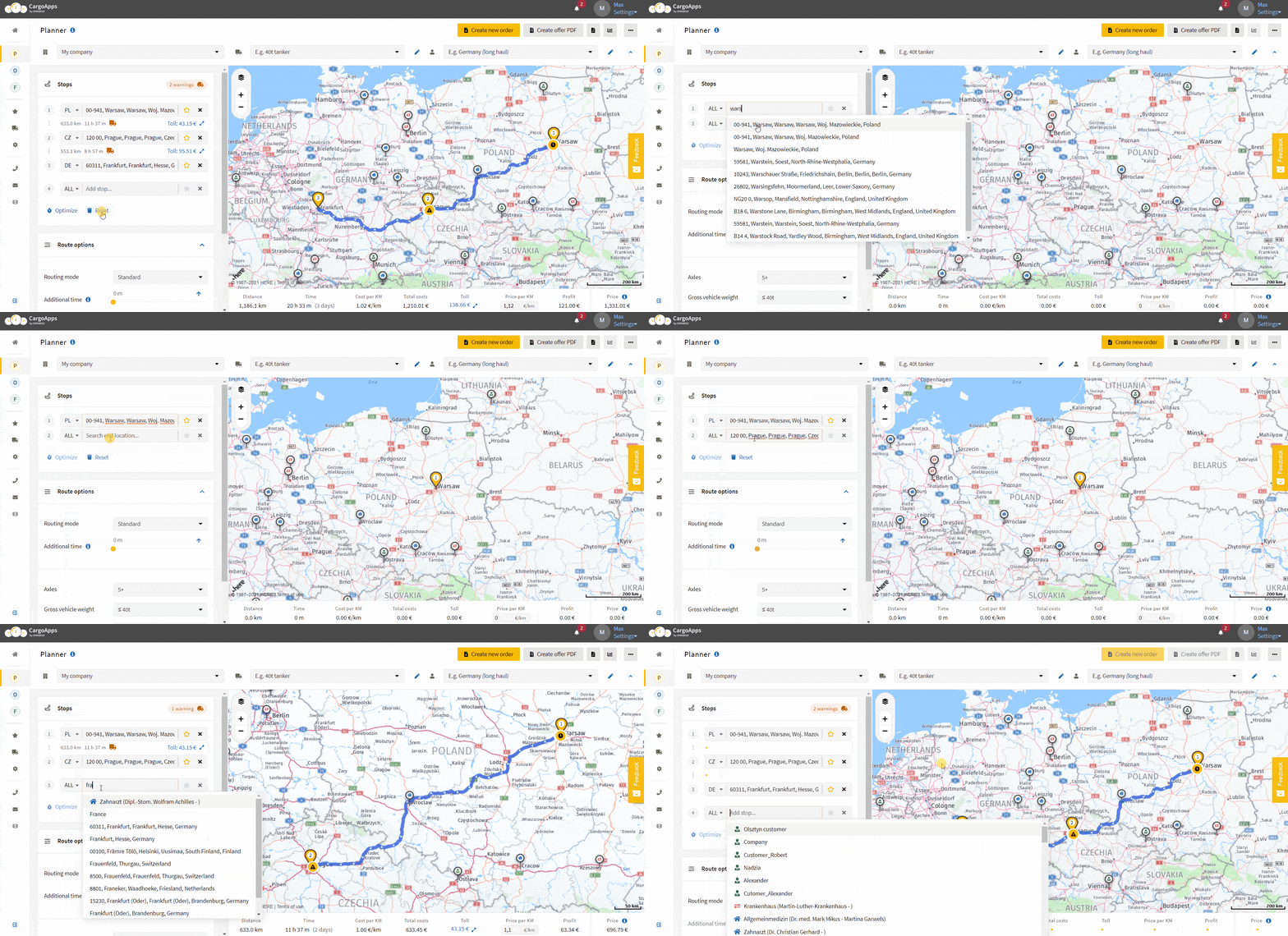
IMPARGO is an all-in-one solution for truck route planning, order management, and driver communication — built specifically for the transport industry.
1. Truck-Specific Navigation
- Routes based on vehicle height, weight, and cargo
- Compliance with road restrictions and truck bans
- Arrive safely and legally
2. Toll and Cost Optimization
- Automatic toll estimation before the trip
- Cost-efficient routing (e.g. avoid tolls)
- Planning based on real kilometers — not estimates
3. Driver Monitoring & Communication
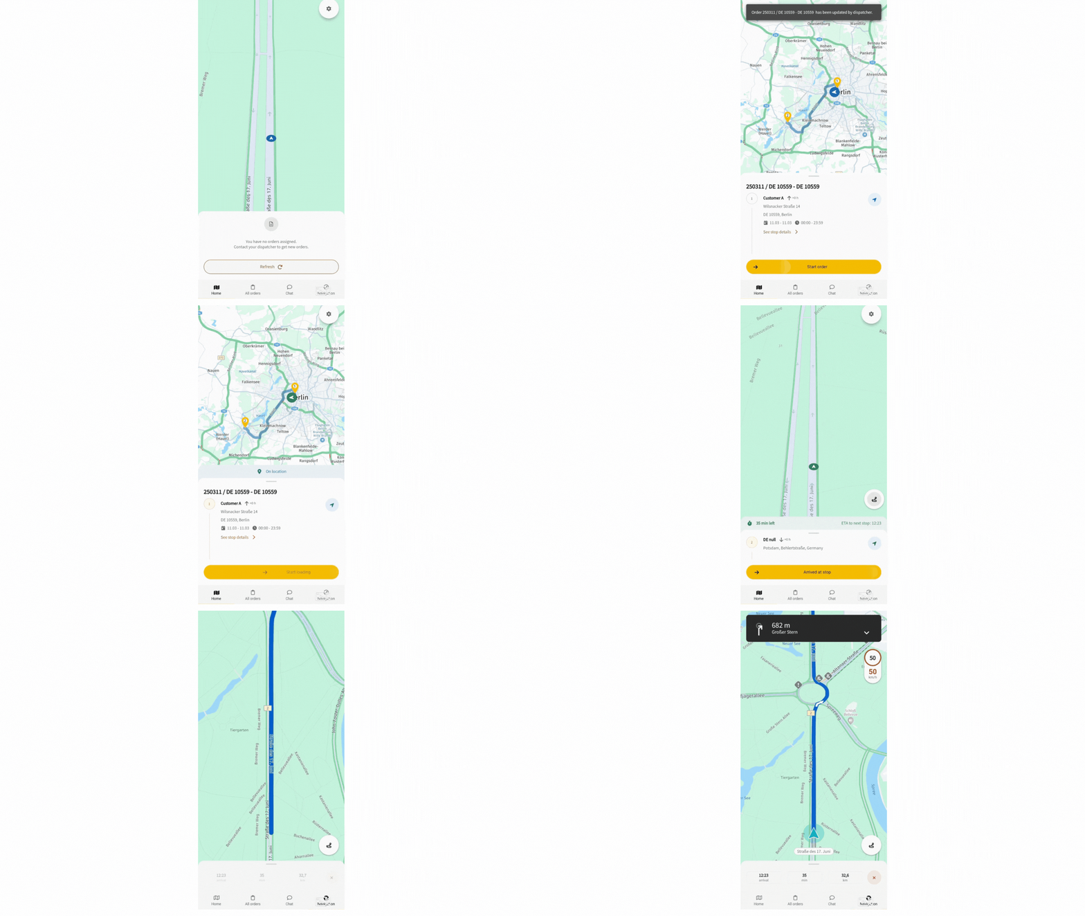
- Send routes directly to the driver app
- Live status and location updates
- Digital messaging — no radio needed
4. Cloud-Based Order Management
- Manage all routes, trips, and orders in one place
- 100% paperless
- Clear overview for both dispatcher and driver
👉 Book your free consultation and simplify your operations today.
Google Maps vs. IMPARGO
| Feature | Google Maps | IMPARGO |
|---|---|---|
| Truck-Specific Routing | ❌ | ✅ |
| Toll Cost Calculation | ❌ | ✅ |
| Driver Communication | ❌ | ✅ |
| Cloud Order Management | ❌ | ✅ |
| Live Traffic & Alternatives | ✅ | ✅ (truck-friendly) |
How to Get Started with IMPARGO

- Book a demo — Get personalized advice from our logistics experts
- Start your free test — Try out the platform immediately
- Optimize your routes — Save time and money with professional planning
👉 Start your free trial or book a 1-on-1 demo
Frequently Asked Questions (FAQ)
📍 Can I use Google Maps for truck routing?
No — Google Maps is designed for cars and does not account for truck-related restrictions like bridge heights or weight limits. A truck-specific tool like IMPARGO is safer and more efficient.
🆓 Is there a free truck navigation app?
Yes, IMPARGO offers a free trial version that includes truck routing, driver communication, and order management.
🚛 What's the best alternative to Google Maps for trucks?
A dedicated truck navigation system like IMPARGO, which includes toll cost estimation, vehicle-specific routing, and integrated logistics tools.
📞 Can I test IMPARGO for free?
Absolutely — you can either test it online immediately or book a 1-on-1 consultation with our team.

