Ever wished you could control what information your truck map displays? Well, with IMPARGO, you can! Just use the Map Layers feature. IMPARGO's interactive truck map layers make your planning experience top-notch. It's not just a map; it's your personalised guide to a hassle-free journey!
How to Adjust the Map Layer
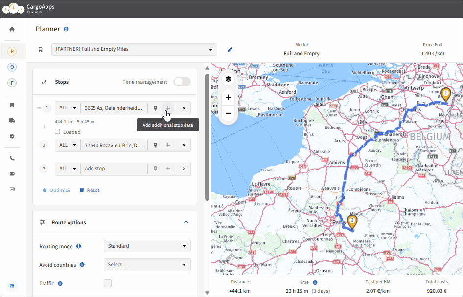
Step 1: Open Planner Module. Open the → truck map by clicking on the "P" (tooltip: "Planner") in the left sidebar.
Step 2: Locate layer icon. Look for the "Layers" icon on the top left of the map and click on it.
Step 3: Select layers. Select or unselect the layer you want or don't want to see by clicking on the layer name (e.g. Traffic). The map will automatically update to show your chosen layers.
To ensure the visibility of all layers on the map, adjust the zoom level appropriately. Certain layers may become invisible if the zoom is set too broadly.
Available Truck Map Layers
Addresses: visually represents your saved addresses with pins on the map. It allows you to precisely filter addresses by category, such as your own location, pickup/drop points, customer addresses, and other custom categories.
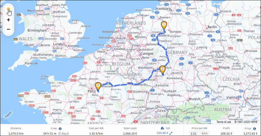
Traffic: shows real-time traffic information like congestion and road closures. This layer displays real-time traffic conditions in both directions. The colour coding is as follows: green indicates clear traffic, yellow signifies light traffic, red denotes heavy traffic, and black represents road closures.
Truck Restrictions: highlights areas with restrictions for HGVs, such as weight, height limits, ADR restrictions, and much more.
Environmental Zones: identifies areas with specific rules for emissions or noise levels.
Traffic Incidents: notifies you of any accidents or hazards impacting the journey of your trucks. Click on the designated diamond-shaped icon of the incident to get details, including type, start date, and estimated resolution date.
Satellite: provides a detailed aerial view of the map. This layer is helpful if you need to identify a location without an address (e.g. field or construction site).
Border Crossing Times: enable this feature to see current border crossing times on the map, shown as colour-coded dots: green for up to 30 minutes, orange for 30–60 minutes, and red for over an hour. Select a dot to see exact wait times at specific crossings. Note: coverage may not include every border crossing.
2. Add Stops via Address Input Field
Enhance your logistical efficiency with IMPARGO's advanced address input feature. Simply enter your desired destinations into our specialised address field to ensure highly precise route planning. This eliminates the need for approximation, as IMPARGO's technology ensures accuracy and reliability in route determination.
How to Add Truck Stops via the Address Input Field
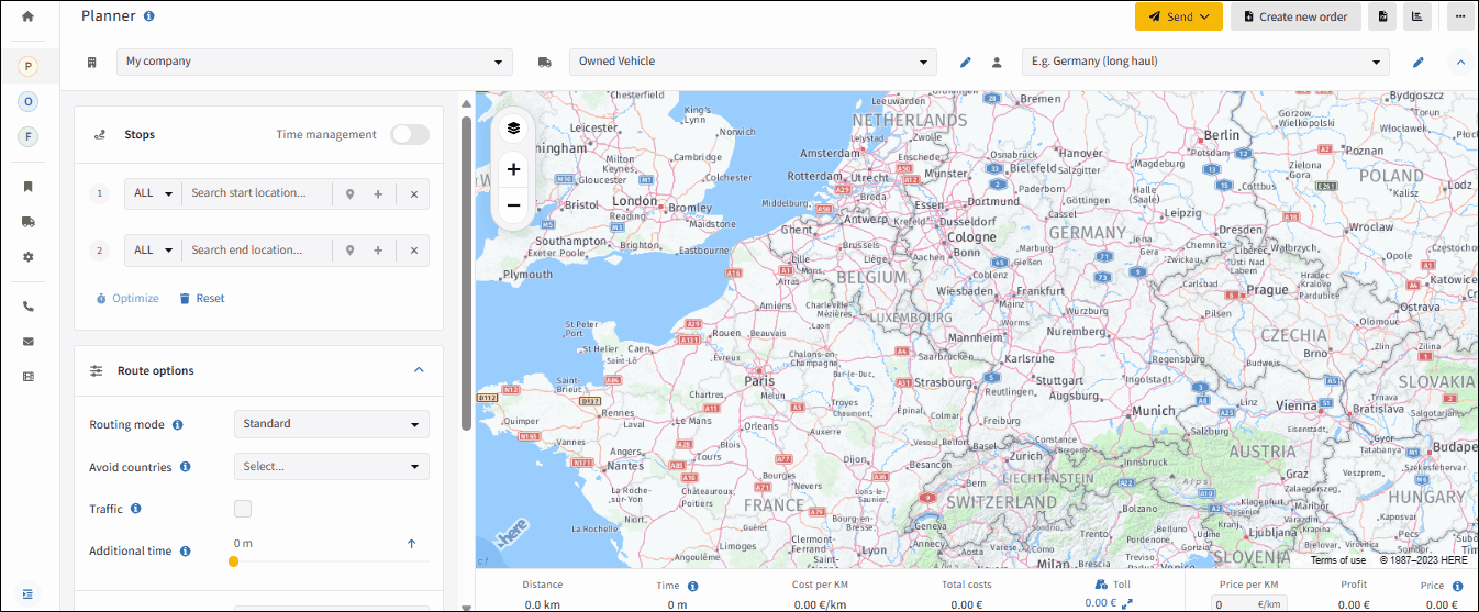
Step 1: Open Planner Module. Open the → truck map by clicking on the "P" (tooltip will display "Planner") in the left sidebar.
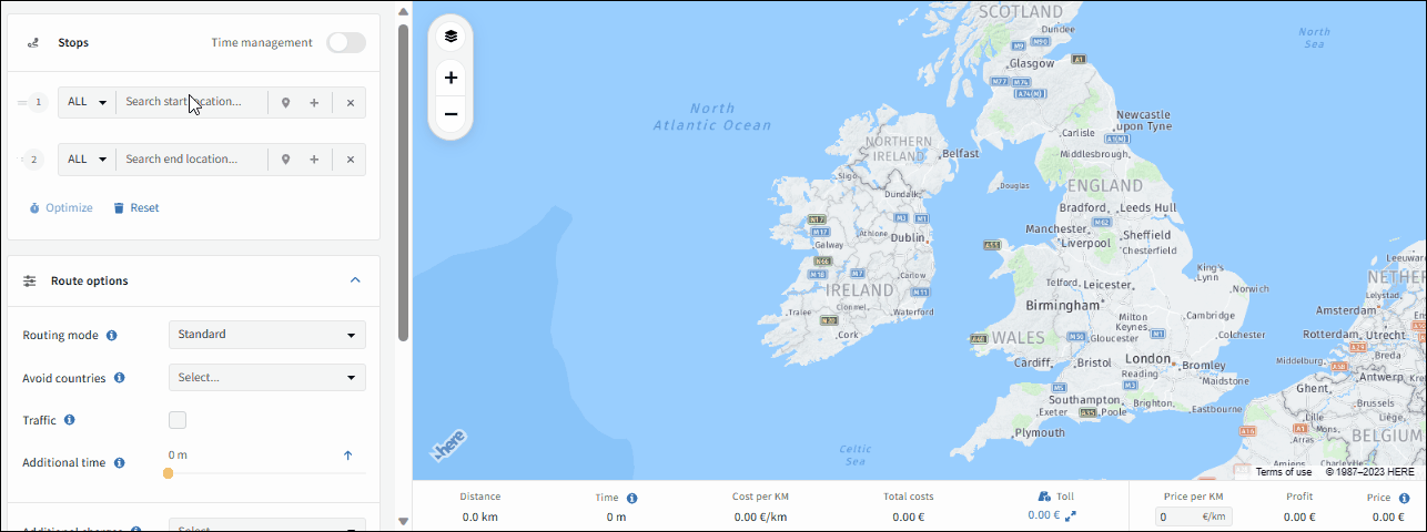
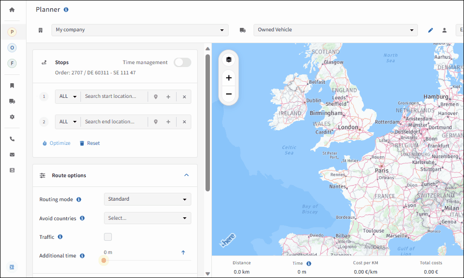
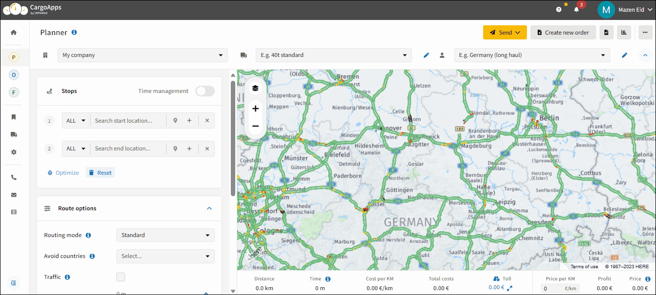
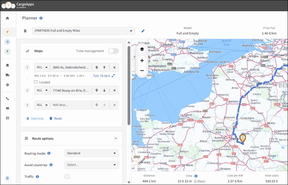
Step 2: Input start location. Input the start location in the "Stops" section on the map's left, by typing your start location in the "Search start location…" field. Upon selection, a yellow marker will indicate the stop on the map.
Step 3: Input end location. Add an end location by filling in the "Search end location…" field with your destination. Upon entering this stop, the system automatically calculates the truck route, adhering to relevant truck restrictions and routing parameters. On the bottom of the map the results of the calculation with truck mileage, operational time, cost per kilometre, total cost, toll cost, price per kilometre, estimated profit, and estimated price will be displayed.
Step 4: Input additional stops. After adding the second stop, a field to insert extra stops appears. Include additional stops by clicking "Add stop…" to include more; leaving it blank keeps the route unchanged.
Maximise Your Address Search Efficiency With These Tips
Locate the Search Bar: the address search bar is conveniently situated in the top left corner of the Planner.
Combine Multiple Details: for precise results, combine the city name, postal code, country, state, and street. The more specific your input, the more accurate the address selection.
Example Search: when searching for "Waldstraße 14 in 2130 Mistelbach, Austria," entering "Waldstraße" initially displays up to 20 addresses with "Waldstraße." Refine your search by adding the street number, postal code, city name, or country.
Country-Specific Searches: restrict your search to a particular country by using the country code before entering the address. You can also utilise geo-coordinates for more precise location data.
Speed Up Navigation: use the combination of arrow keys and the Tab key to quickly navigate through search results. This technique is especially useful during customer phone calls when a quick quote is needed.
Limit Search to a Specific Country: click on the country code field near the address input field (defaulted to "ALL") and select your desired country code. This will restrict address suggestions to the selected country, ensuring more specific and accurate results.
Envision navigating a map and identifying a desired location for your route without knowing its name. With IMPARGO's advanced truck route planner, this challenge is effortlessly addressed. Users can directly interact with the map to incorporate any location into their route, bypassing the need for specific names. The process is streamlined through a series of straightforward steps, allowing for intuitive additions directly on our dynamic map.
How to Add Stops Using the Truck Route Map
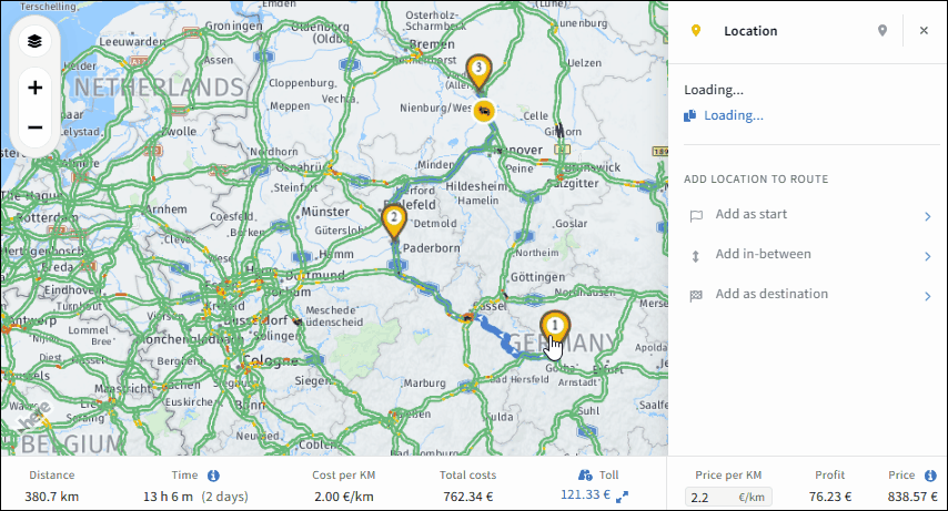
Step 1: Open location submenu. Initiate a right-click on the desired location on the map to reveal a submenu, offering various functionalities. The submenu provides you with exact coordinates of this location, the ability to add it as a stop, or save it as an address.
Step 2: Add stop. Select your required stop type from three distinct options provided by the platform:
Click on "Add as a start" to add your chosen stop as a starting point.
Click on "Add in-between" to add the chosen stop in between your already planned stops.
Click on "Add as a destination" to add the chosen stop as the next destination.
IMPARGO's Excel Import Stops feature streamlines dispatch management, reducing manual entry time for stops and therefore saving you costs. Seamlessly upload and import Excel stop lists into our Truck Route Planner to improve efficiency and cost-effectiveness.
How to Import Truck Stops via Excel Sheet
Step 1: Create Excel upload sheet. Create an Excel sheet containing the route information for your stops. Make sure to organise the columns according to the available options in the IMPARGO system.
For Geolocation, Choose One of the Four Options
Full address field: provide one field with the complete address for each stop.
Longitude & Latitude fields: enter the longitude and latitude coordinates for each stop in two separate fields.
Country, City, Zip code, and Street fields: maintain four separate fields with country, city, zip code, and street for each stop.
Favourite name: use names of saved addresses to be used as stops. Based on the names the system will automatically detect if it is a saved address.
Additional Non-Compulsory Upload Options
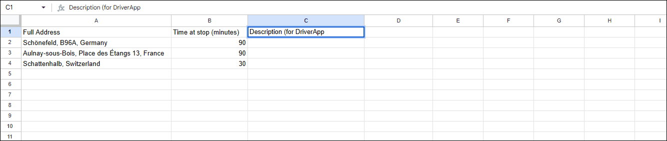
Time at stop in minutes: specify the duration of the stop in minutes for each stop (optional).
Description: specifying additional info for each stop can make the communication via the DriverApp more efficient (optional).
Start time window: define the start time window for each stop (optional).
End time window: define the end time window for each stop (optional).
Providing an accurate address is essential for the system to read it correctly. Other columns are optional but can provide additional details for better route planning.
Step 2: Open Planner Module. Access your IMPARGO account and navigate to the → Planner Module.
Step 3: Locate upload function. In the Planner, select the (…) button on the top right corner (tooltip indicates "More actions") and choose "Import stops".
Step 4: Upload Excel. Upload your prepared Excel sheet when prompted on the import screen.
Step 5: Align tags. Ensure accurate data interpretation by aligning the column tags from your Excel sheet with the corresponding fields in the IMPARGO system. Accomplish this by clicking and holding the left mouse button on the tag, then dragging it to the appropriate field.
Step 6: Set header recognition. Confirm whether the first row of your Excel spreadsheet serves as headers for column names or as address information. Subsequently, adjust the system's recognition settings to reflect this by either selecting or deselecting the option "First Row Contains Column Names".
Step 7: Initiate import. After mapping and reviewing your data, initiate the import process by clicking "Import". Observe as IMPARGO efficiently imports and displays your stops on the map view, facilitating a comprehensive visualisation of your routes.
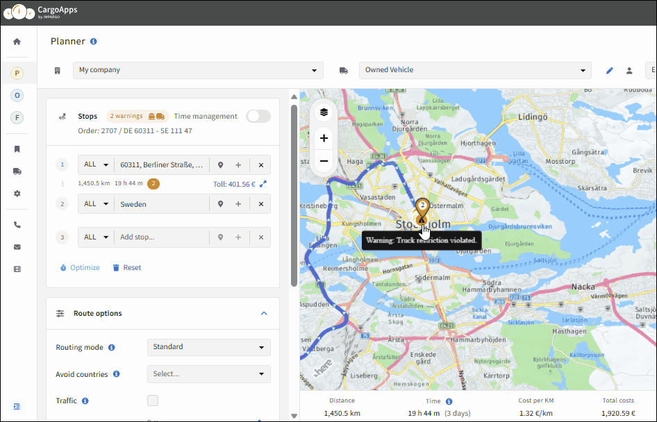
Enhance your journey's safety and efficiency with IMPARGO's comprehensive interactive map. Our advanced warning indicators serve as vigilant guardians, highlighting critical information such as truck restriction violations, unpaved roads, and ferry crossings along your planned route. Experience peace of mind with a digital assistant tailored to your truck's requirements, providing real-time updates to navigate through potential road challenges. With IMPARGO, prioritising your fleet's safety and ensuring a seamless journey becomes effortless.
Warnings appear directly on the map or adjacent to the address input field. To access more information, hover your mouse over the warning indicator.
What Are the Warning Indicators for Your Truck Route?
⚠ Warning
The Planner flags three categories of route risks that you should review before sending the route to the driver: truck restriction violations, unpaved roads, and ferry crossings.
1. Truck Restriction Violations: IMPARGO's interactive map displays warning indicators for truck restriction violations. These violations can include road segments with weight restrictions, height limitations, or other specific limitations that are not suitable for your truck and mostly occur if one of the stops is not reachable without violating a truck restriction. When you encounter such a warning indicator, it is important to consider an alternative route to avoid any potential violations. Move the mouse towards the warning indicator for detailed information about the restriction.
2. Unpaved Roads: To ensure the safety and optimal performance of your trucks, IMPARGO identifies unpaved roads on the interactive map. Unpaved roads may present challenges such as poor road conditions, limited traction, and increased wear and tear on vehicles. When you come across a warning indicator for an unpaved road, it is advisable to select an alternative route if possible. This will help maintain the efficiency of your operations and minimise any potential vehicle damage.
3. Ferry Crossings: IMPARGO recognises ferry crossings along your truck route. Ferry crossings may impact the overall trip duration and require additional logistical considerations. When a ferry crossing warning indicator appears on the interactive map, it is essential to account for the ferry schedule and plan your route accordingly. Be aware that the mileage of the ferry is not included in the total distance; however, the travel time is included in the operational time.
6. Save Stop as Address
Discover a helpful trick on IMPARGO: you can save your favourite stop addresses for future tours in the truck route planner. It's like keeping a list of your go-to spots! Plus, add those little details about each stop to make communication smoother and keep everyone in the loop. IMPARGO isn't just a platform — it's your sidekick in making transportation management easy.
How to Save Truck Stop Addresses
Step 1: Open address data submenu. Click on the "Save Address" icon adjacent to the destination input field in the Truck Route Planner — a submenu for detailed address data will open.
Step 2: Add or adapt address data. Overwrite address data or add precise address information such as Name of address, Address category, Contact email, Contact person, Phone number, and Comment.
Step 3: Save address. Click on the "Save to My Address" icon to permanently save the address in your address selection, or click on "Use one time address" to only save the data in the current transport order.
Alternatively, click on the location pin on the map or right-click on your desired address and find the save address icon on the top right corner of the opened submenu.
Making sure we have extra stop details is a game-changer for smooth communication within the IMPARGO Platform. We're talking about adding stop activities, keeping track of how much time we spend at each stop for accurate cost calculations, and giving our drivers all the extra info they need right in the DriverApp. It's all about making things easy and efficient!
How to Include Truck Stop Activities in Your Route Planning
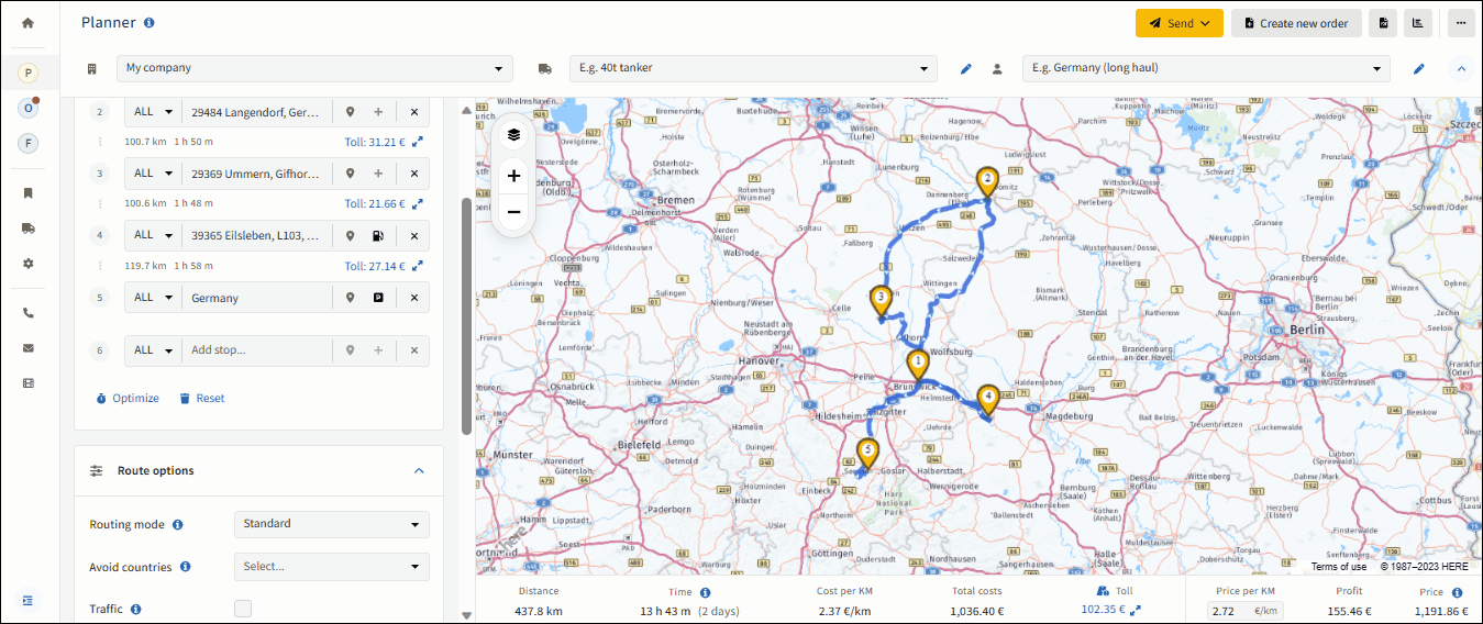
Step 1: Add additional stop data. Click on the (+) icon next to the desired stop in the Route Options section.
Step 2: Choose stop activity. You will have four activity options to select: loading, unloading, parking, and refuelling.
Step 3: Calculate time spent at stop. You can also provide time spent at the stop for overall cost calculation and additional information for the driver to see in the DriverApp.
8. Add Loading Unit Details
When selecting Additional Stop Data, you have the flexibility to choose between different types of loading units, such as pallets or containers. By choosing Additional Stop Data, you can add specific loading unit details for accurate communication.
How to Add Loading Units in Your Transport Management System
Step 1: Access submenu. Access the additional stop data submenu and click on "Add loading units".
Step 2: Choose loading unit and edit details. Include the loading unit type, quantity, and dimensions. Additionally, you can add loading metres and references for each stopping activity.
Step 3: Add custom loading unit (if needed). You have the option to choose between default types of loading units (pallets, containers, etc.), or you can just create your own New Custom Loading Unit.
Beyond loading units, IMPARGO supports bulk products — cargo measured by tonne, litre, or cubic metre rather than counted units. This includes cement, gravel, grain, fuel, milk, and waste. Bulk products integrate directly with the Planner Module's price and cost calculation and can be reported on by drivers via the DriverApp at the weighbridge (truck scale).
How to Add Bulk Product Details to Your Truck Route
Step 1: Open the Planner module. Go to apps.impargo.de/planner and build the route you're working on.
Step 2: Add your stops. Add the loading stop and the unloading stop for the run on the route.
Step 3: Open the stop activity panel. In the Planner, the bulk-product button is nested behind the stop activity panel. Click the stop activity (+) button next to the address to expand Additional stop data, then click + Add bulk product.
Step 4: Choose or create a bulk product. Open the Type dropdown. It lists your previously used bulk products as presets — pick one if it matches. To create a new product, choose + New bulk product at the top: a second modal opens where you specify the type (Solid, Liquid, or Gas), enter a name, and optionally flag the product as a disposal good when costs apply at unloading rather than loading. Save and you're back in the original modal with the new product preselected.
Step 5: Enter quantity, price, and cost. Enter the planned quantity (in tonnes, m³, or litres depending on the product unit), the price per unit you charge the customer, and your internal cost per unit. The order's price and cost totals at the bottom of the map update immediately.
Working in Orders Instead?
If you're working in the Orders module rather than the Planner, the + Add bulk product button sits as a component button directly under each stop — no stop activity panel to open first. The fields you fill and the result for the driver are identical to the Planner flow above. See Manage Bulk Products in Your Orders for the Orders module walkthrough.
Automatic recalculation: quantities reported later by the driver via the DriverApp automatically update price and cost — no manual update needed.
Reusable in templates: bulk products can be saved as part of order templates for recurring lanes.
Visible on the order and PDFs: bulk products show inline in the order detail view and on generated PDFs (confirmation, delivery note, invoice), just like loading units.
Key Point
The Planner Module sums all line items in the order into one price and cost total — and recalculates automatically when the driver reports the actual quantities via the DriverApp.
Example — 24 t of gravel
An order carries 24 t of gravel: your price 12,00 €/t → 288,00 €, your cost 7,00 €/t → 168,00 €. The gravel line adds 288,00 € to the order Price and 168,00 € to the order Cost — a 120,00 € margin on this line. If the driver later reports only 22,5 t actually loaded, Price drops to 270,00 € and Cost to 157,50 € — automatically. No manual recalculation.
Note: For full details on managing bulk products end-to-end — including disposal goods, the bulk products summary, customer tracking links, and reusing them in order templates — see Manage Bulk Products in Your Orders.
10. Add Custom Loading Unit
Alternatively, you can create your very own New Custom Loading Unit for personalised specifications. This allows for a tailored and adaptable approach to your loading unit details.
How to Create a Custom Loading Unit
Step 1: Locate function. To create a custom loading unit, click on the loading unit field option at the top of the Additional Stop Data menu.
Step 2: Add new custom loading unit. Choose "New Custom Loading Unit" and provide a name, dimensions, quantity, weight, and stackability for your customised loading unit.
Overall, optimising the truck tour in dispatching is essential for enhancing operational efficiency, reducing costs, improving customer service, and maximising resource utilisation. This feature allows dispatchers to plan and optimise different types of truck tours — for example, round trip — with only one click.
How to Optimise Your Truck Tour
Step 1: Locate optimisation function. Find the "Optimise" function conveniently positioned under the address box.
Step 2: Perform optimisation. Activate the "Optimise" feature, especially when dealing with complex routes. The system will dynamically adapt your route to optimise its sequence.
Sequence optimisation: select "With First Stop Fixed" if you have a specific starting point that must remain fixed in the sequence.
Roundtrip optimisation: select "With First and Last Stops Fixed" if both the initial and final stops need to maintain their positions.
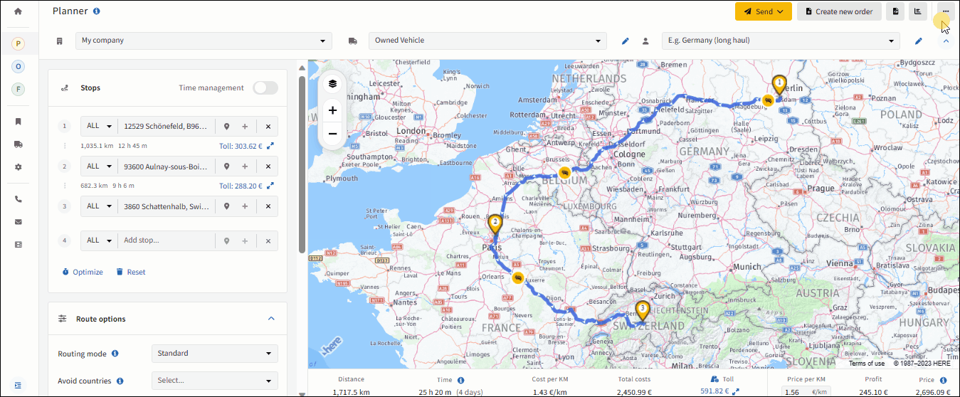
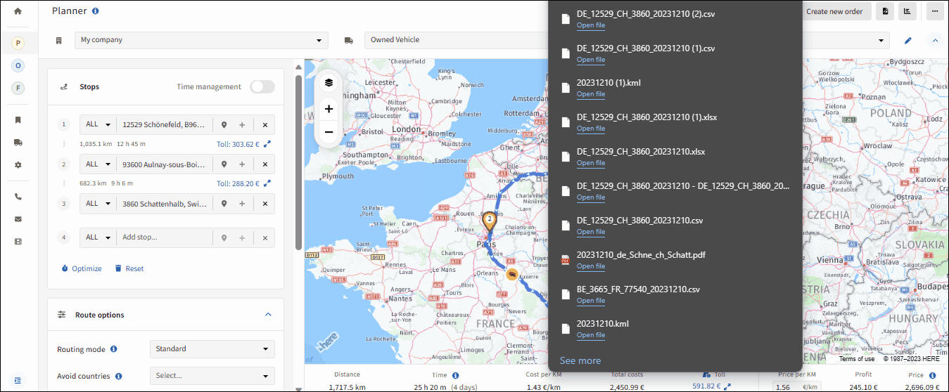
You can export your stops as Excel sheets and your route as a .KML file in IMPARGO. These export features allow you to save and share your data for further analysis, reporting, or integration with other systems or tools.
How to Export Your Truck Route to an Excel Sheet
Click on the "More options" button located at the top right corner of the Planner to expand the options menu, and select "Export stops" to initiate the export process. The system will generate a CSV or XLSX file containing your stops and their corresponding details. The file will be downloaded to your device, and you can access it to view or further process the exported data.
Click on the "More options" button to reveal the additional options menu and select "Export route" to start the export process. The system will generate a .KML file that encapsulates your route. The file will be downloaded to your device, and you can open it using KML-compatible applications or software (e.g. Google Maps).
Build truck-legal routes, see distance, time, toll, and cost per kilometre as you go, catch restriction and ferry warnings before they reach the driver, and reorder multi-stop tours with a single click. Compare route variants and lock in your margin before you quote.