In this guide, we'll show you how to leverage IMPARGO’s advanced route planning tools to reduce costs, avoid delays, and streamline your logistics operations. Learn best practices and strategies for planning an effective truck route, leading to smoother, more predictable journeys.
1. Plan Truck Route
Planning a truck route requires careful consideration to ensure timely deliveries, fuel efficiency, and compliance with local traffic regulations. Whether you're managing a single truck or an entire fleet, optimizing your routes can significantly impact your logistics efficiency and bottom line.
Here's how to plan a truck route in 4 steps:
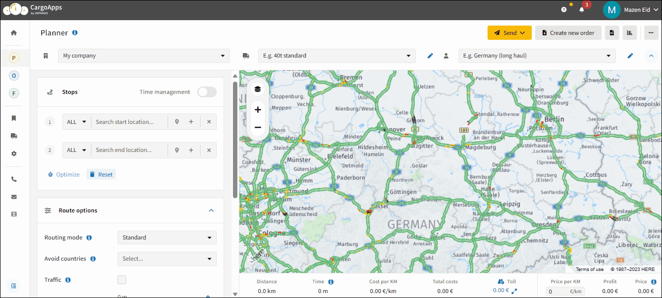
Step 1: Open the Planner module. Open the → truck map by clicking on the "P" (tooltip will display “Planner”) in the left sidebar.
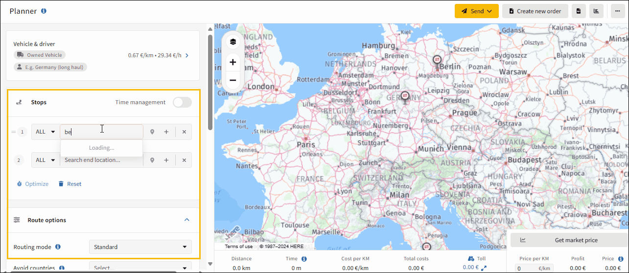
Step 2: Input start location. Input the start location in the “Stops” section on the map's left, by typing your start location in the “Search start location…” field. Upon selection, a yellow marker will indicate the stop on the map.
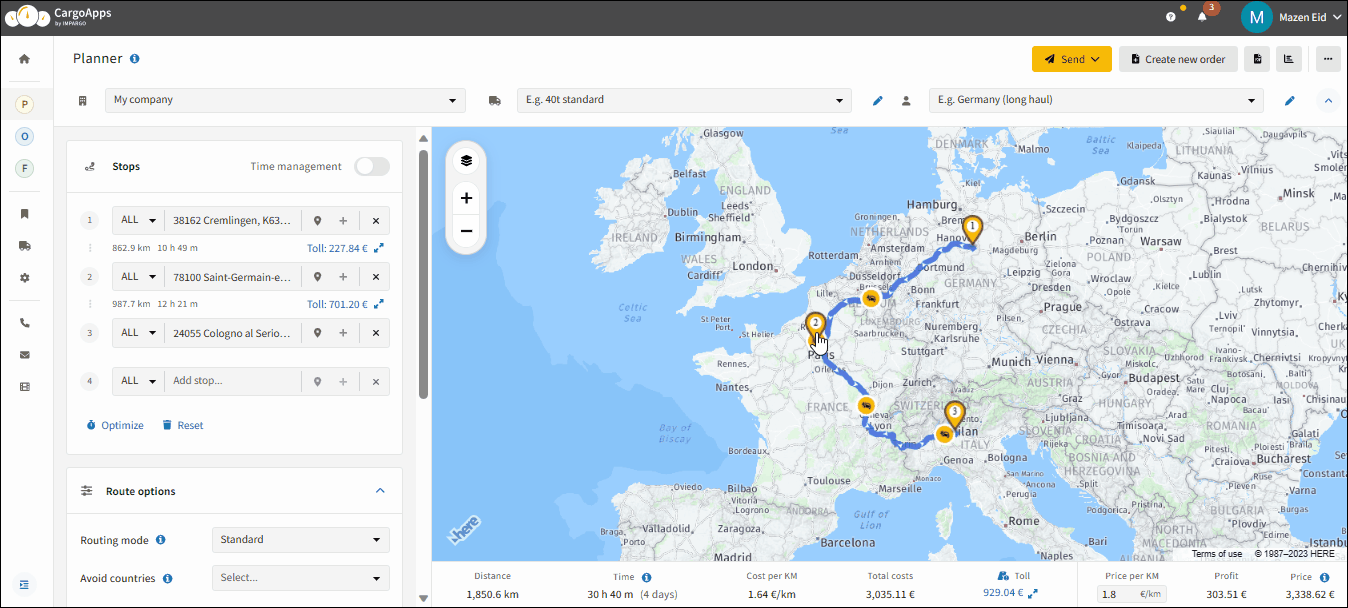
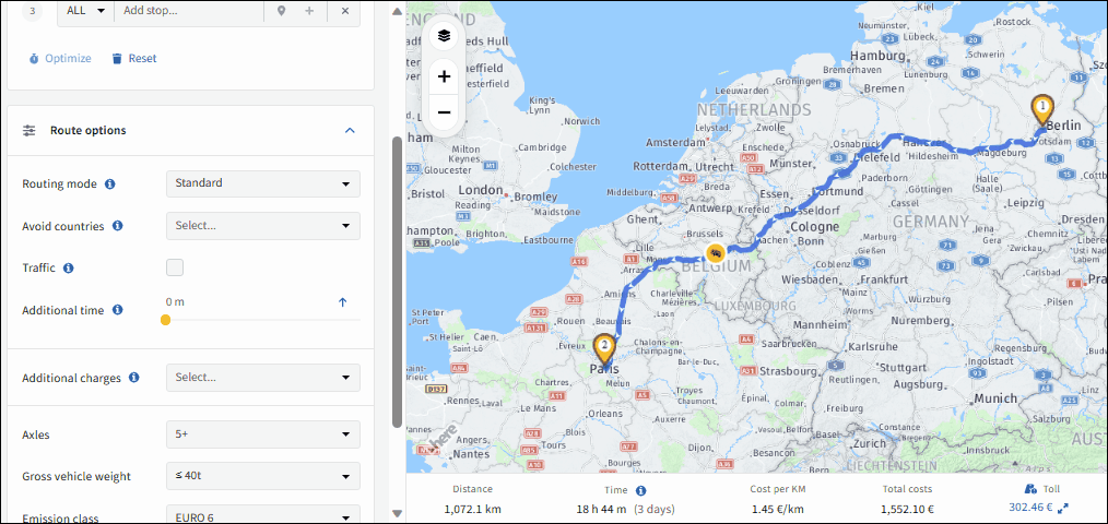
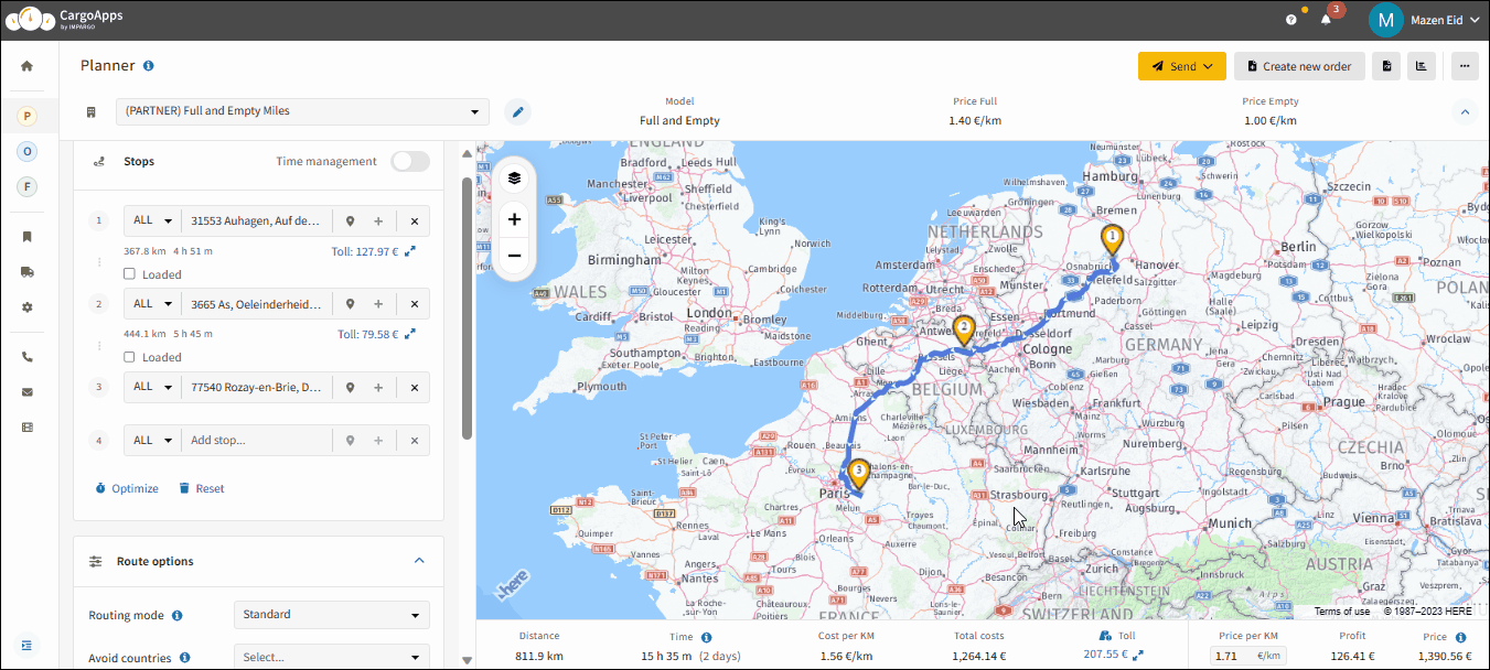
Step 3: Input end location. Add an end location by filling in the “Search end location…” field with your destination. Upon entering this stop, the system automatically calculates the truck route, adhering to relevant truck restrictions and routing parameters. On the bottom of the map the results of the calculation with truck mileage, operational time, cost per kilometer, total cost, toll cost, price per kilometer, estimated profit and estimated price will be displayed.
Step 4: Input additional stops. After adding the second stop, a field to insert extra stops appears. Include Additional Stops by clicking “Add stop…” to include more; leaving it blank keeps the route unchanged.
The address search bar is located in the top left corner of the → Planner Module.
To make your search efficient, smartly combine the city name, postal code, country, state, and/or street. The more specific you are, the more accurate the address selection will be.
For example, if you're searching for "Waldstraße 14 in 2130 Mistelbach, Austria", after entering "Waldstraße", up to 20 addresses with "Waldstraße" will be displayed. To refine the search, specify the address with a street number, postal code, city name, or country.
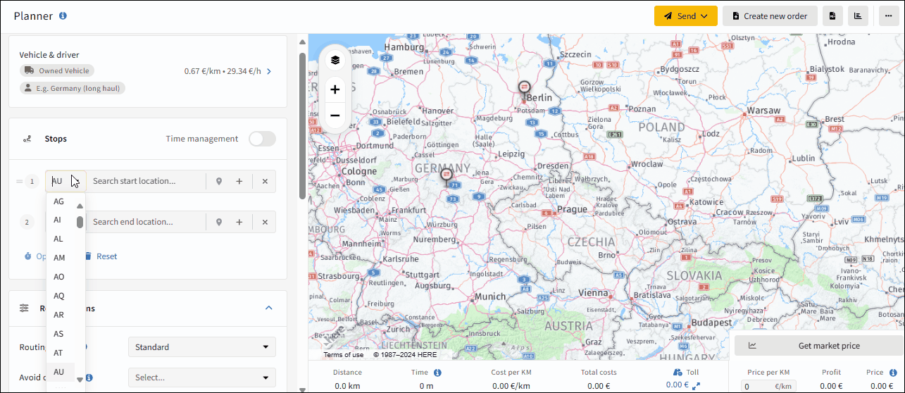
The search can be restricted to a specific country by using the country code before entering the address. There's also the option to use geo-coordinates.
A tip to speed up the search is the combination of arrow keys and the Tab key. Use the arrow keys to navigate through the results and select the desired result with the Tab key. This is particularly useful during phone calls with customers when a quick quote needs to be given without additional steps.
Limit the seach on a country by clicking on the country code field near the address input field (named “ALL” by default), selecting your desired country code for specific and accurate address suggestions. Addresses will then only be found in this specific selected country.
This feature empowers dispatchers to adapt the by IMPARGO suggested route to their needs and their desired route in real-time. By strategically adjusting routing via points, dispatchers can navigate through dynamic challenges such as traffic fluctuations, road closures, and varying delivery priorities the system is not aware of.
Here's how to change routing using Points:
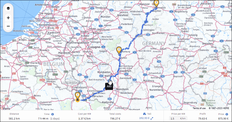
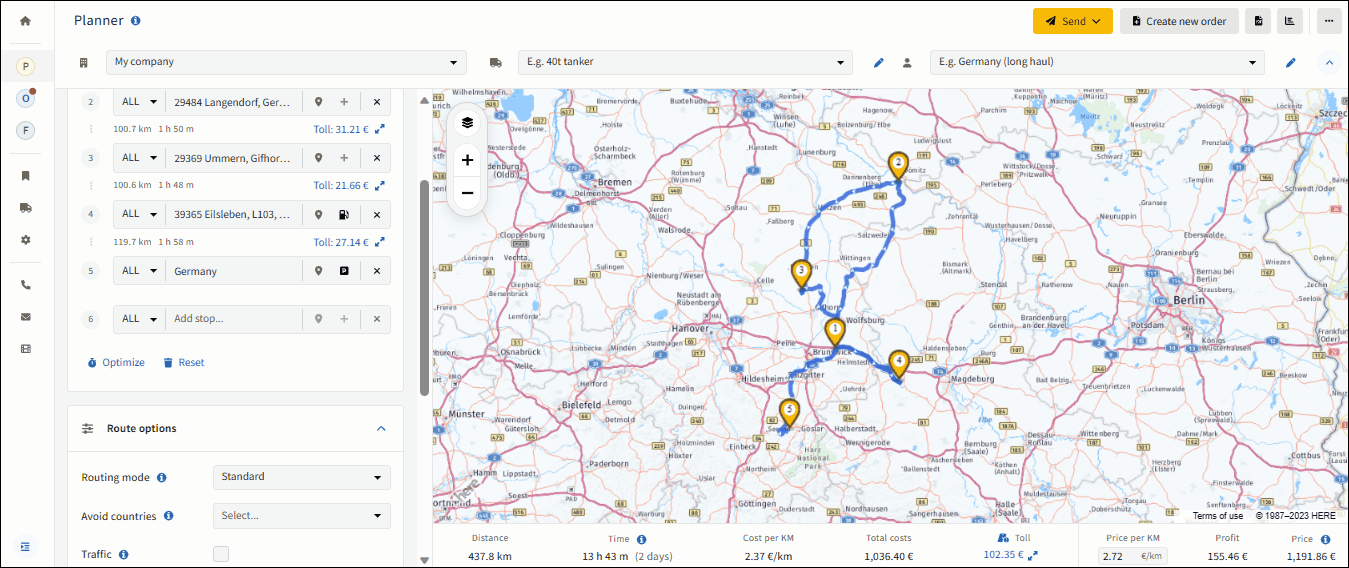
Step 1: Add via point. Click and hold the left mouse button on the blue route and drag it to your desired location or street. A via point, marked by a blue and white circle, will appear, and the route will automatically adjust to pass through this point.
Step 2: Add additional via points. Add multiple points to fine-tune your driver’s journey as needed.
Step 3: Delete via point. To delete a via point, simply click on it.
Note:With this feature the route planner can be enforced to ignore a specific truck restriction. Just drag & drop the route directly on the restriction. In the most cases this truck restriction will then be ignored - warnings however will probably appear.
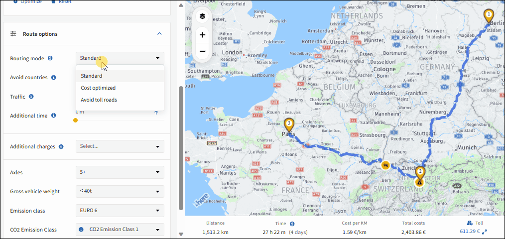
The strategic selection of the right routing mode is not just a preference; it's a fundamental element influencing the planned route with impact on toll cost, costs, mileage and driving time. Whether prioritizing speed, cost-effectiveness, or avoiding tolls, the chosen routing mode serves as the blueprint for the entire journey.
Here's how to choose the right routing mode for your truck:
The Planner Module offers three routing modes: Standard, Cost Optimized and Avoid Toll Roads.
Standard: This mode is usually the fastest and most common chosen route.
Cost Optimized:This mode selects the most optimal route based on general transportation costs, including vehicle, driver, and toll costs.
Avoid Toll Roads:This mode prioritizes routes that avoid toll roads optimizing the overall toll spend. Latter is majorly possible in countries like France, where toll roads effectively can be avoided.
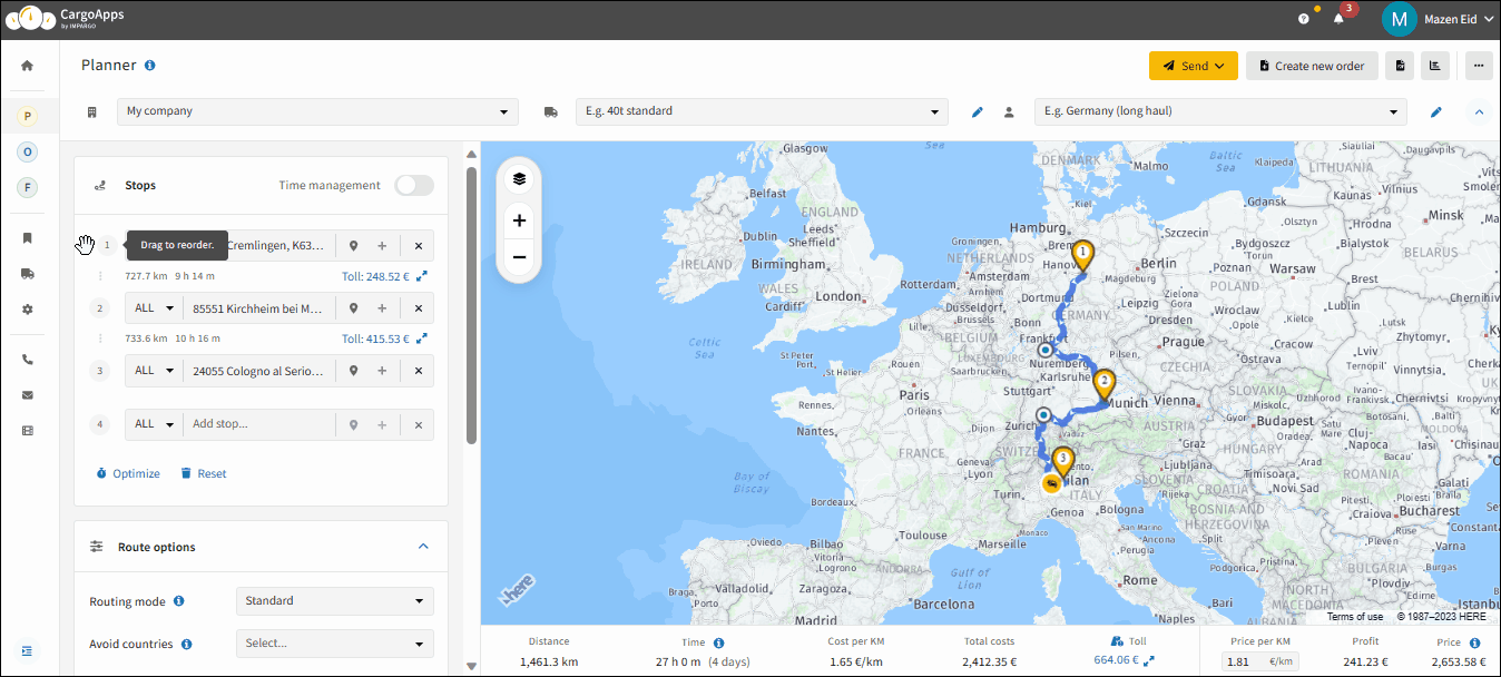
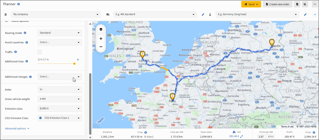
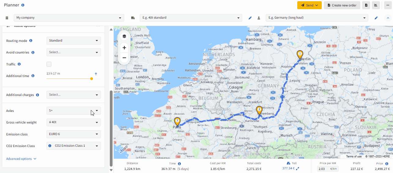
This feature provides dispatchers with the flexibility to dynamically adjust the order of stops, optimizing routes for maximum efficiency. By accommodating changing priorities, unforeseen circumstances, or specific delivery requirements, dispatchers can ensure that trucks navigate the most efficient path.
Here's how to change truck stops sequence: Method #1:
Step 1: Find drag icon. Hover over the stop's number to see it change to a drag icon and display “Drag to reorder” as a tooltip.
Step 2: Change order of stops. Press and hold the left mouse button on the drag icon to move the stop to your preferred position.
Efficient stop sequencing is pivotal for enhancing dispatching efficiency, cutting costs, elevating customer service, and optimizing resource use. It's particularly beneficial for planning and executing tasks or deliveries with more than 3 stops, ensuring optimal productivity and customer satisfaction.
To optimize your stops sequence, follow these steps:
Step 1: Find “Optimize” function. After entering all stops, locate the "Optimize" button below the address input field.
Step 2: Perform optimization. Use the "Optimize" feature for complex routes to automatically refine the stop sequence. For routes requiring a fixed starting point, choose “With First Stop Fixed” (Sequence Optimization). If both the start and end points must remain unchanged, opt for "With First and Last Stops Fixed" (Rountrip Optimization).
If you need to avoid specific countries during your route, IMPARGO offers an option to exclude them from your journey. Whether it's to comply with regulations, optimize transit times, or address specific operational preferences, this functionality ensures that your routes are tailored to your exact specifications, offering a seamless and customizable solution for efficient and hassle-free logistics management.
Here's how to avoid countries for your truck route planning:
Step 1: Find “Avoid countries” field. Find “Avoid countries” multi-select field in the Route Options section on the left side of the map.
Step 2: Select countries to avoid. Select the countries you wish to avoid, and the platform will calculate an alternative route accordingly.
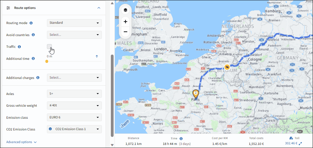
The integration of live traffic data into IMPARGO's interactive map equips dispatchers with a powerful tool to navigate the dynamic nature of road conditions. By combining live-traffic information, historical traffic data, and long-term closure information, the system ensures that your route planning reflects real-world conditions as accurately as possible. This leads to more reliable delivery times, optimized routes, and higher overall efficiency.
How to enable live traffic in your route planning
Step 1: Find the “Traffic” option. In the → Planner Module, go to the Route Options section on the left side of the map and locate the check box labeled “Traffic”.
Step 2: Enable the function. Activating the check box incorporates both live traffic data and historical traffic patterns into the truck routing.
Step 3: Specify a departure time. You can set a departure date and time to simulate expected traffic conditions. For future departures, the system relies on historical traffic data. For immediate departures, it also considers live-traffic conditions.
Important clarifications
Long-term closures: Road closures lasting longer than one day are classified as long-term closures. These are only considered in routing if the “Traffic” function is enabled.
Traffic data: With “Traffic” enabled, routing considers both live traffic and historical data.
Recommendation: Always set the departure time as realistically as possible. This ensures the routing accounts for the correct traffic conditions (live or historical) and any long-term closures.
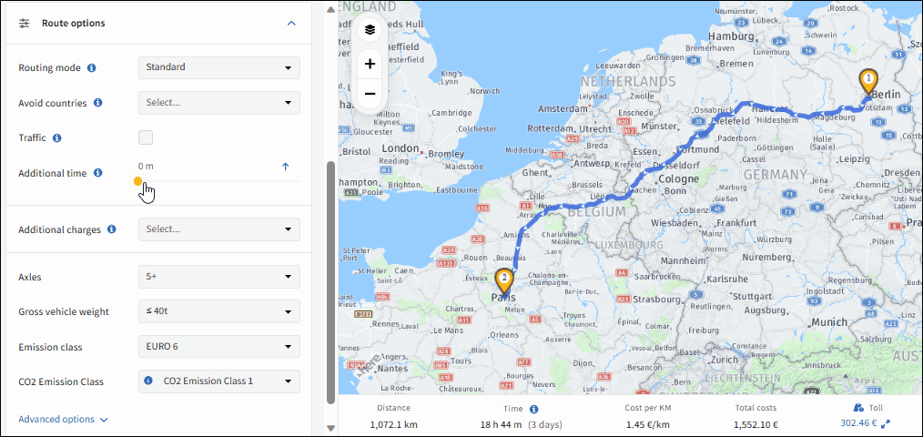
The Additional Time feature in the IMPARGO truck route planner is a vital tool for dispatchers, enabling proactive management of time-sensitive aspects in trucking operations. By allocating extra time, you affect the total operational duration and, consequently, the trip's overall costs. IMPARGO offers you to add additional time either on a stop level or on a tour level.
To effectively add additional time per stop, follow these steps:
Step 1: Open additional stop data submenu. Click on “+” on the right side of the address input field within the “Stops” section in the → Planner Module.
Step 2: Find time at stop slider. Locate the time at stop slider and adjust the time the vehicle and the driver are expected to stay at this stop for actions like loading, unloading, parking or refueling.
You will instantly see the adjustment of the operational time at the bottom of the map, along with the corresponding cost adjustments.
For your fleet, costs adjust based on your vehicle’s and driver’s hourly rates.
For subcontractors, a waiting time surcharge from the subcontractor cost profile applies.
The Additional Time feature in the IMPARGO truck route planner is a vital tool for dispatchers, enabling proactive management of time-sensitive aspects in trucking operations. By allocating extra time, you affect the total operational duration and, consequently, the trip's overall costs. IMPARGO offers you to add additional time either on a stop level or on a tour level.
To add additional time per truck tour, follow these steps:
Step 1: Adjust additional time slider. Adjust the operational time by utilizing the “Additional Time” slider to incorporate extra time for activities like loading, unloading, breaks, or additional waiting periods. For your fleet, costs adjust based on your vehicle’s and driver’s hourly rates. For subcontractors, a waiting time surcharge from the subcontractor cost profile applies.
Step 2: Extend additional time to full day. To extend the operational time to a full day, click the arrow (↑) beside the slider. For subcontractors, 8 hours are the default setting. For your fleet, the driver’s working hours set the threshold.
The Additional Charge feature in route planning offers a significant advantage for achieving detailed and accurate cost estimates. By incorporating custom additional charges such as ferry costs, driver premiums, or administrative fees, planners can enhance financial forecasting. This ensures a comprehensive cost assessment, leading to a more accurate depiction of a transportation journey's financial impact. Moreover, this feature promotes transparency and efficiency in communication with stakeholders, thereby aiding in making well-informed decisions and refining logistics strategies with a broader financial perspective.
To add additional charges in your truck route planning, follow these steps:
Step 1: Find additional charges function. In the → Planner Module, find the "Additional Charges" section within the Route Options on the map's left side.
Step 2: Select charges. Click on the “Additional charge” field. Choose the charge you wish to include in the transport cost from the dropdown.
Step 3: Add new charges. Add custom charges by clicking inside the “Select” field and select “+ Add new”. Input the name and value of your custom additional charge. Confirm by clicking “Add additional charge”.
Incorporating specific vehicle attributes into route planning is essential for tailoring transportation strategies to the unique capabilities of your fleet. By detailing critical information like vehicle dimensions, weight capacities, and additional pertinent attributes, businesses can fine-tune routes to match fleet compatibility. This careful planning prevents issues related to height and weight restrictions and promotes journey safety, efficiency, optimal load distribution, fuel economy, and adherence to regulatory standards.
Step 1: Find routing settings. In the → Planner Module on the left side of the map at the bottom of the Route Options section, you will find fields where you can add general information about the selected vehicle's attributes.
Step 2: Adapt the vehicle settings. Enter the number of axles, specify the gross vehicle weight, and provide the emission class of the vehicle.
The vehicle settings which are relevant for the routing of the vehicle can be preset in the vehicle and trailer profiles.
Changing the profiles will overwrite the settings in the “Route Options”.
If the settings are changed in the “Route Options” and do not match with the currently selected vehicle and trailer profiles a warning will be indicated: “Settings do not match with the selected vehicle profiles…”.
Leveraging advanced vehicle options in route planning is pivotal for boosting operational efficiency, minimizing risks, and ensuring logistics operations are fully tailored to the fleet's specific attributes.
Here's how you utilize vehicle “Advanced options” section:
Step 1: Locate the "Advanced options" section. In the → Planner Module, navigate to the "Advanced Options" section to locate the hazardous goods field.
Step 2: Adapt the settings. Indicate, if the vehicle is transporting hazardous goods. Enter the vehicle's axle weight and height. Specify the vehicle's average speed, which is crucial for accurate routing and scheduling.
Step 3: Enable or disable tolls.
You can also choose whether to include tolls in the overall price for your transport offer.
The system calculates the average speed for the trip based on the road type, with highways, city roads and other road types each having designated speeds, ensuring route calculations are as accurate as possible.
The average speed will then determine the driving time as part of the operational time.
Proper planning minimizes risks, meets regulatory requirements, and optimizes transportation costs. In this guide, we offer a smart solution on how to effectively plan a truck route for hazardous goods using IMPARGO’s advanced tools, enabling you to streamline your logistics while adhering to the stringent ADR regulations.
Follow these steps to avoid areas restricted for hazardous goods:
Step 1:Locate the "Advanced options" section. In the → Planner Module, navigate to the "Advanced Options" section to locate the hazardous goods field.
Step 2: Select hazardous goods categories. Choose one or more hazardous goods categories to tailor the route for compliance and safety, avoiding restricted areas.